
Normandy 🇫🇷 // 03-2024
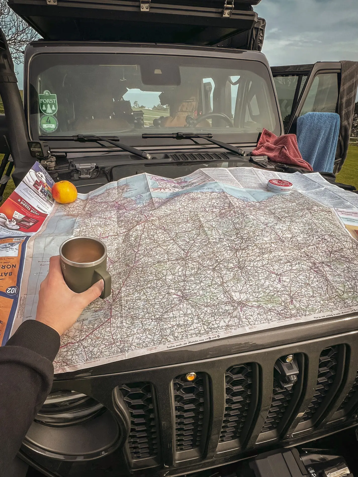
Our first joint trip with @jeepy_the_wrangler led us to Normandy on the French coast. Our route followed various landing sectors and the paratrooper operations conducted inland in preparation for the landing, including Pegasus Bridge, Gold Beach, Utah Beach, Carentan, and Sainte-Mère-Église. For our travel companion, this was their first time on a military history tour, a challenge we gladly embraced.
What happened on D-Day?
D-Day, also known as the Normandy landings, took place on June 6, 1944, and was one of the largest amphibious military operations in history. The goal was to end the German occupation of Western Europe and pave the way for the Allies to liberate Europe.
The landing began with a massive air and sea bombardment, followed by the landing of about 156,000 soldiers on five beach sections of Normandy, codenamed Utah, Omaha, Gold, Juno, and Sword.
Paratrooper operations also played a crucial role. On the night before the landing, over 13,000 paratroopers from the U.S. 82nd and 101st Airborne Divisions, as well as the British 6th Airborne Division, were dropped behind German lines. Their tasks were varied: securing important bridges and roads, disrupting German troop movements, and securing landing beaches from the land side.
In the scenically beautiful Normandy, countless traces of the battles can still be found today.
The Locations

Day 1 - Bunkers & Cliffs
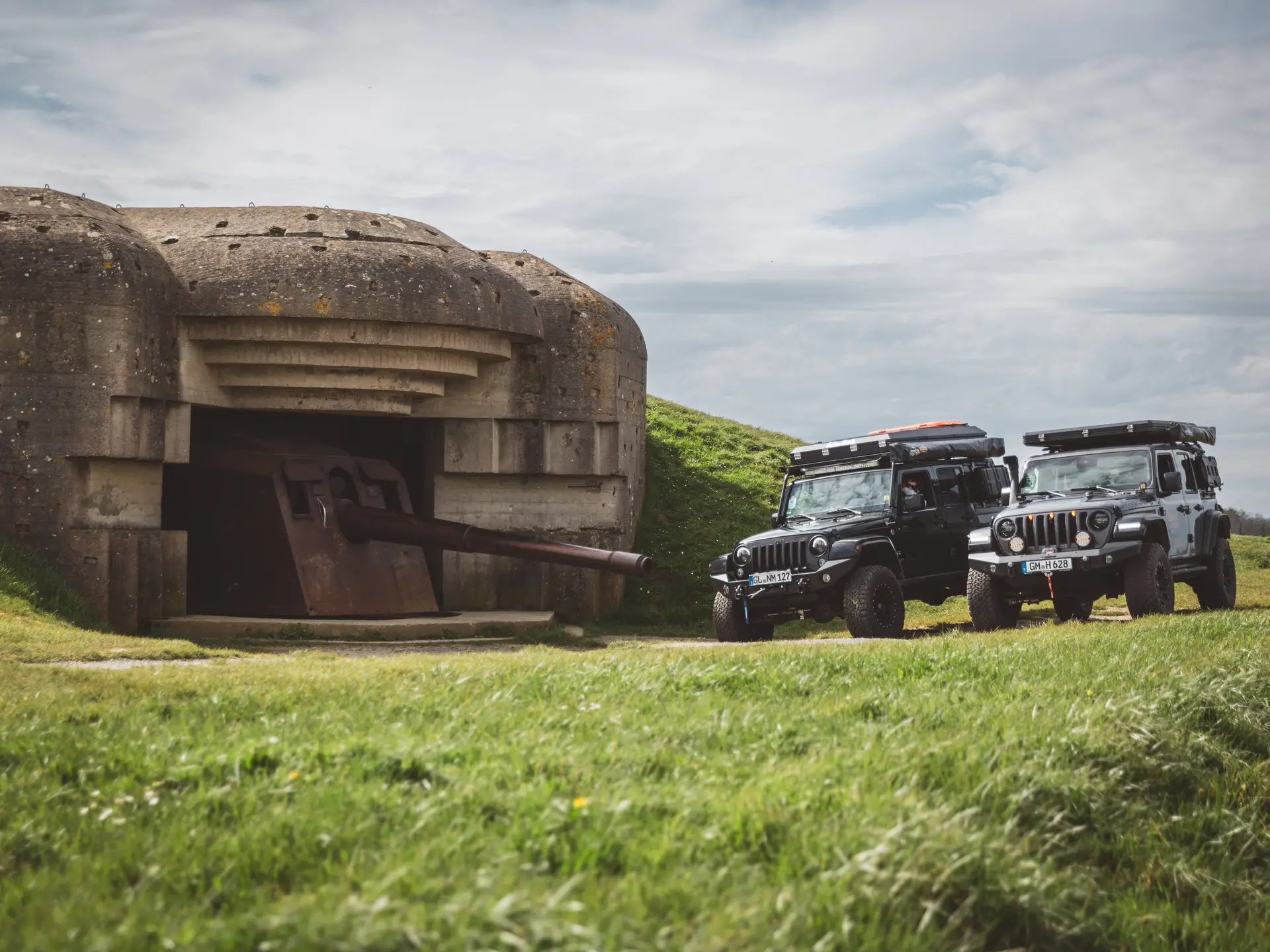
Observation Bunker of HKB Heuqueville
One of the most impressive bunker complexes along the Atlantic Wall is also one of the riskiest to visit.
This army coastal battery was intended to serve as a defensive facility on the cliffs and had six open positions for 10.5 cm guns to combat ships in the northern English Channel near Le Havre. Particularly striking is the observation bunker of the fire control center on the cliff.
The front observation area of the large bunker juts out over the 100-meter-high cliffs due to years of erosion.


How to get there?
- Observation Bunker of HKB Heuqueville on Google Maps,
Coordinates: 49°37’00.4″N 0°08’08.0″E
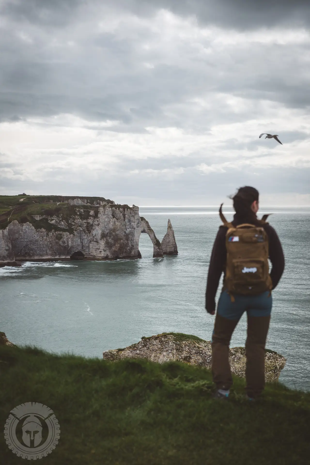
Cliffs at Étretat
A short hike on the cliffs of the chalk rocks of Étretat. Afterwards, we set up camp.


How to get there?
- Parking in Étretat on Google Maps,
Coordinates: 49°42’27.3″N 0°12’05.6″E - Start of the hike north along the beach, up the stairs:
Coordinates: 49°42’36.0″N 0°12’14.2″E
Day 2 - Pegasus Bridge & Mulberry "B" Harbour
Pegasus Bridge & Museum
On the night of June 5 to 6, 1944, three Horsa gliders of the 6th British Airborne Division landed discreetly a few meters away from the bridge in Bénouville. Their emblem is the image of a Pegasus, which later became the namesake for the bridge.
The goal of the men of the 6th British Airborne Glider was to capture the bridge and the neighboring structures in Ranville, cut off the Germans' supply route, and support the imminent Allied landing.
Just a few hours after the arrival of the paratroopers, the mission succeeded, and they managed to repel heavy German counterattacks and hold the bridge until reinforcements arrived via Sword Beach.
Today, the original bridge stands in the museum, right next to the enlarged replica that replaced it after the war.


How to get there?
- Museum with original bridge on Google Maps,
Coordinates: 49°14’35.4″N 0°16’20.1″W - Replica of the bridge, today in use, on Google Maps,
Coordinates: 49°14’32.9″N 0°16’27.6″W
Temporary Harbor Mulberry 'B'
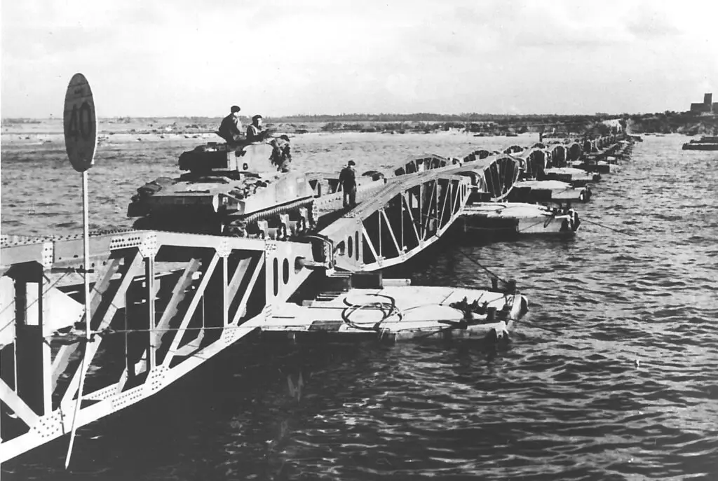
The Mulberry harbors were two artificial supply ports built by the Allies on the coast of Normandy during World War II.
Mulberry 'A' was designated for the Americans at Vierville-sur-Mer (Omaha Beach), while Mulberry 'B' was intended for the British at Arromanches (Gold Beach).
The harbors were designed to provide shelter from the rough sea and allow ships to unload despite the tides. This was achieved by sinking older ships and concrete caissons to form an artificial reef. Further out, large metal structures called Bombardons were installed to break the waves. The piers needed to adapt to the tides, which was made possible by long metal poles embedded in the caissons, allowing the pier heads to move up and down.
Construction began on June 7, 1944, one day after the landings. Within just three days, the first ships could be unloaded. The harbors were scheduled for completion by June 20, but a storm from June 19 to June 22 nearly destroyed Mulberry 'A'. The Americans decided not to repair it but instead used its parts to reinforce Mulberry 'B'. At Vierville-sur-Mer/Saint-Laurent-sur-Mer, they continued unloading ships directly onto the beach, which proved to be more efficient.
The British Mulberry 'B' soon became operational. By October 31, a total of 628,000 tons of supplies, 40,000 vehicles, and 220,000 soldiers had been unloaded there.
We took a scenic hike along the beach and returned via the cliffs above. Of course, a burger at 'Sergent Willy’s' was a must!


How to get there?
- Remains of Mulberry 'B' on Google Maps,
Coordinates: 49°20’31.8″N 0°37’13.1″W,
Best visited at low tide. - Sherman Tank on Google Maps,
Coordinates: 49°20’24.2″N 0°37’07.1″W - D-Day 75 Garden on Google Maps,
Coordinates: 49°20’22.0″N 0°37’00.9″W
Day 3 – Battery, Overlord Museum & American War Cemetery
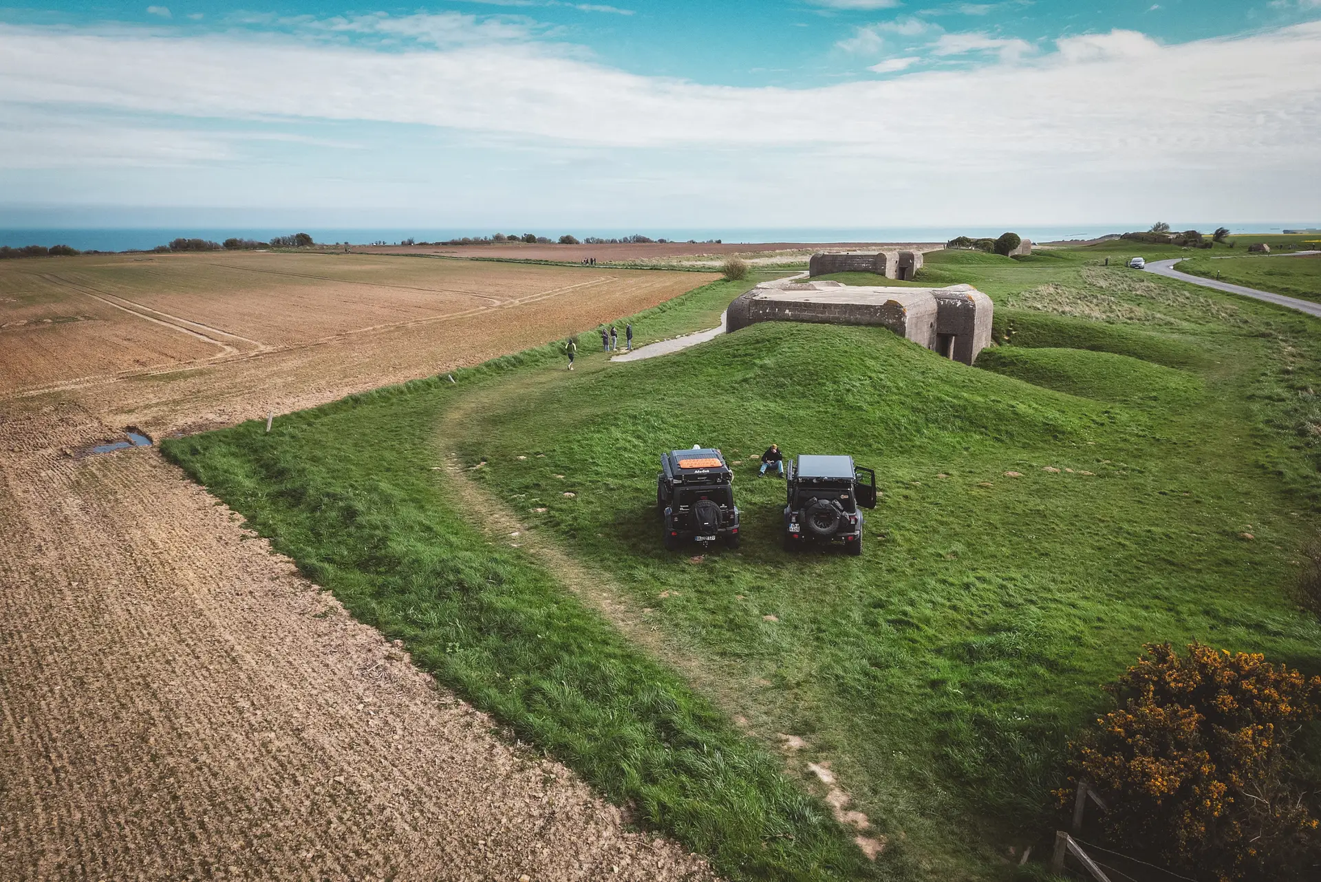
Battery Longue-sur-Mer
The Longues-sur-Mer coastal battery is a historic military installation from World War II in Normandy, France. It is the only preserved German gun emplacement that was part of the Atlantic Wall. During the Normandy landings on D-Day, the battery played a crucial role, engaging in a prolonged artillery duel with ships of the invasion fleet for several hours.


How to get there?
- Battery Longue-sur-Mer on Google Maps,
Coordinates: 49°20’36.2″N 0°41’41.5″W
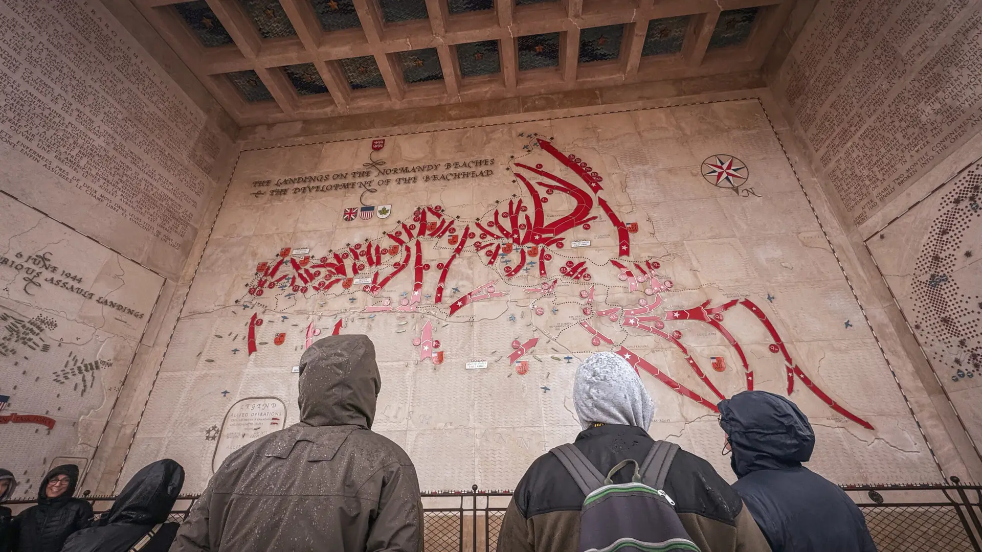
Overlord Museum


How to get there?
- Overlord Museum on Google Maps,
Coordinates: 49°20’52.4″N 0°51’22.6″W,
Website: www.overlordmuseum.com
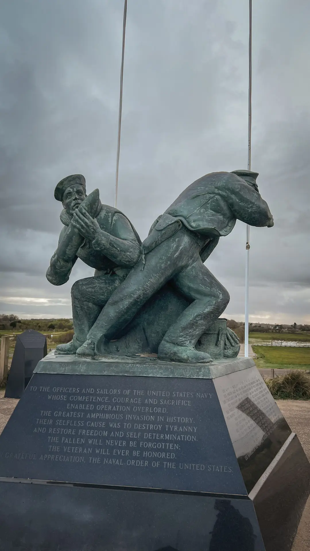
American War Cemetry Omaha Beach
The Normandy American Cemetery is a memorial dedicated to the U.S. soldiers who lost their lives during the Normandy invasion and the subsequent battles of World War II. The cemetery is located on a cliff overlooking Omaha Beach and contains 9,388 graves, most marked by white marble crosses and Stars of David.


How to get there?
- American War Cemetry on Google Maps,
Coordinates: 49°21’33.5″N 0°51’19.5″W
Day 4 – Carentan, Dead Man's Corner, Easy Company & Utah Beach
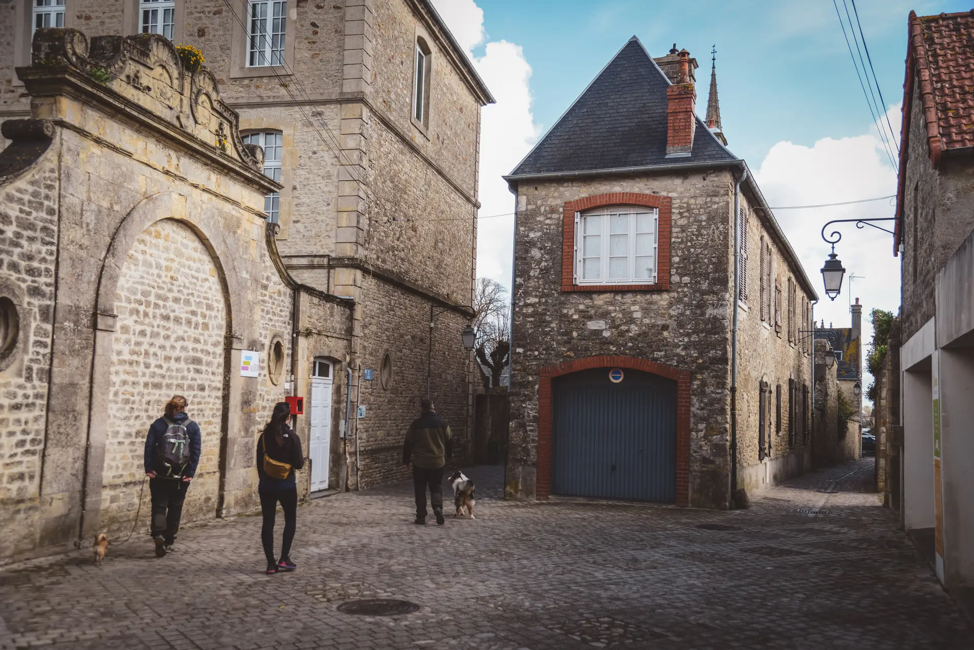
City of Carentan
After the Allied landings on June 6, 1944, Carentan became a strategically important objective, as the town served as a connection between the Utah and Omaha beachheads. Securing control of Carentan was crucial to linking the two landing zones and establishing a continuous foothold.
The Battle of Carentan took place from June 10 to June 15, 1944. American paratroopers of the 101st Airborne Division fought against well-entrenched German forces, including units of the 6th Parachute Regiment. After intense fighting, the American troops eventually managed to capture the town. This allowed the Allies to consolidate their forces and push the German troops further back.


How to get there?
- Carentan on Google Maps,
Coordinates: 49°18’20.6″N 1°14’35.7″W
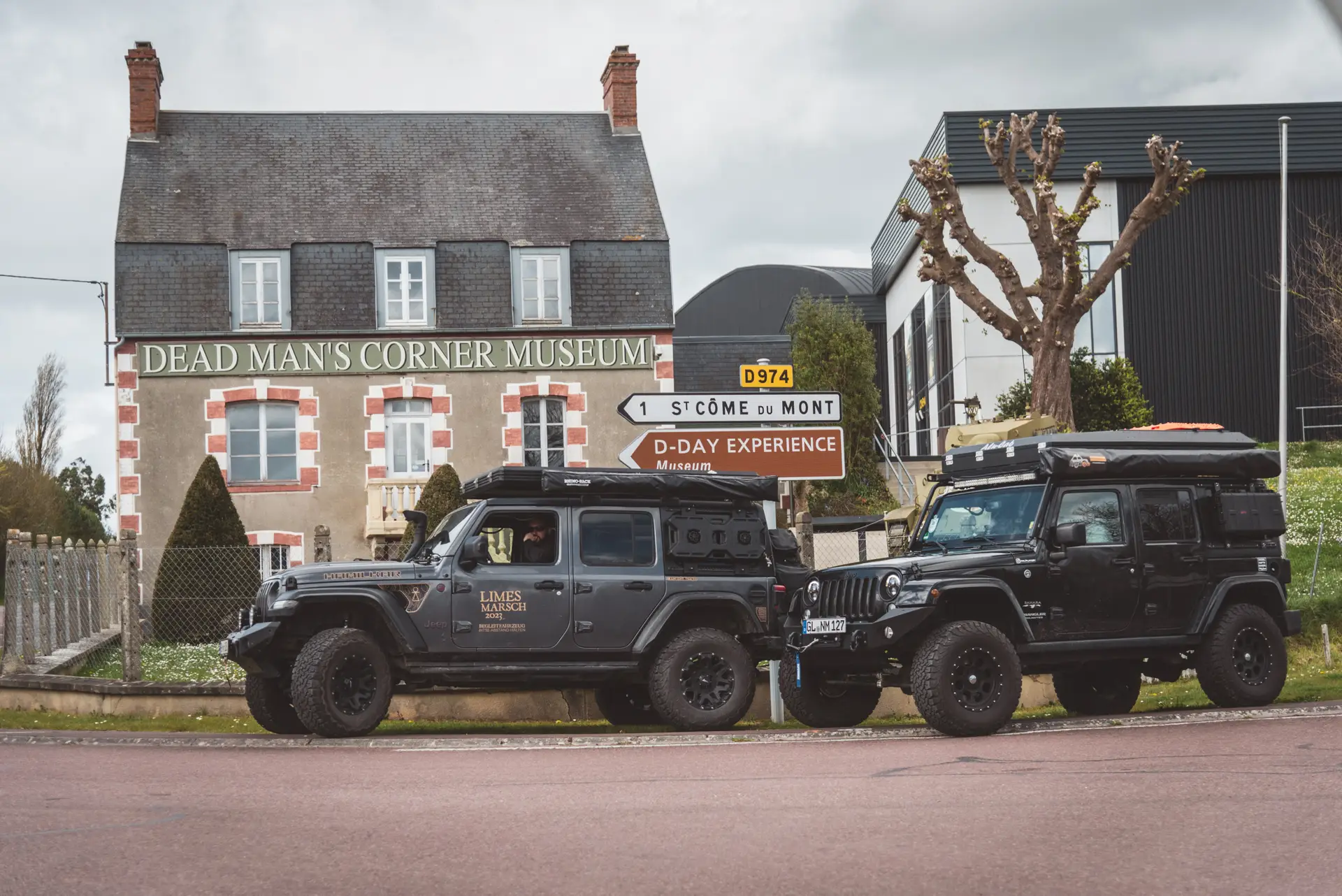
Dead Man's Corner Museum with D-day Experience
The name originated when an American tank was destroyed at this street corner, and the deceased commander remained in the vehicle for several days. The location marked a critical point during the battles following D-Day, especially for the paratroopers of the 101st U.S. Airborne Division.
Today, Dead Man’s Corner houses a museum dedicated to the history of the airborne troops and the events around Carentan. The D-Day Experience presents this in a particularly immersive way, featuring a C-47 flight simulator and a 3D cinema.


How to get there?
- Dead Man’s Corner with D-Day Experience on Google Maps,
Coordinates: 49°19’43.7″N 1°16’07.6″W,
Website: www.dday-experience.com
Easy Company Memorial & HQ
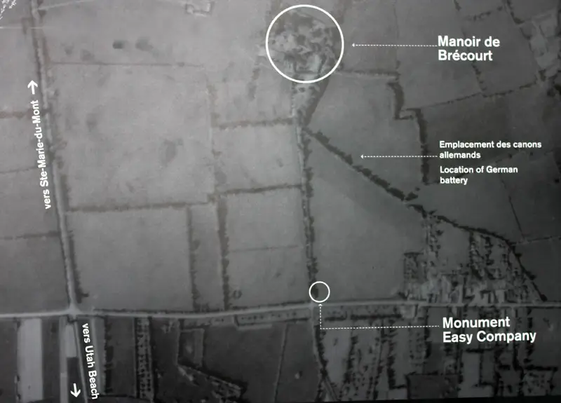
The attack on Brécourt Manor took place on D-Day and was carried out by Easy Company of the 101st Airborne Division under Lieutenant Richard Winters. Their mission was to eliminate a German artillery position near Brécourt Manor, which was shelling the landing forces at Utah Beach. They successfully destroyed four German 105mm howitzers, preventing further bombardment of the invasion troops. This assault is often cited as a textbook example of small-unit tactics and leadership in overcoming a larger enemy force. Winters and his men received several commendations for their bravery. The battle is depicted in great detail in the series Band of Brothers.


How to get there?
- Easy Company Memorial on Google Maps,
Coordinates: 49°23’30.6″N 1°13’21.4″W - Former Command Post of Easy Company on Google Maps,
Coordinates: 49°23’34.8″N 1°13’28.6″W,
Private Property - German Positions at Brécourt Manor (famous Easy Company assault) on Google Maps,
Coordinates: 49°23’24.4″N 1°13’34.4″W,
Not accessible, as it is private property.
Utah beach
The westernmost landing sector of the Allies was included in the invasion plan for D-Day to secure the port of Cherbourg as quickly as possible for supply operations.


Day 5 - Saint-Mère-Église
Saint-Mère-Église Church
On the night of June 5 to June 6, 1944, American paratroopers landed in the marketplace of Sainte-Mère-Église. The colorful stained-glass windows of the church are dedicated to the landing of the Allied troops on the beaches of Normandy. Among the depictions is a Virgin Mary surrounded by airplanes and paratroopers
The mannequin 'Big Jim,' which hangs from the church tower today, commemorates John Steele. During his parachute jump, his chute got tangled in the church spire, and he lost his knife, leaving him unable to free himself. He hung there for hours. A German soldier shot at him but only wounded him, so Steele played dead. Later, another German soldier, searching for chocolate and cigarettes, cut him down and realized he was still alive, taking him prisoner. However, Steele managed to escape and rejoined his unit. He survived the war.


How to get there?
- Church of St-Mére-Eglise on Google Maps,
Coordinates: 49°24’32.1″N 1°18’59.1″W
Airborne Museum


How to get there?
- Airborne Museum on Google Maps,
Coordinates: 49°24’30.9″N 1°18’55.0″W,
Website: www.airborne-museum.org
Information Sources & Literature Used for Planning:
In addition to Google Maps, Wikipedia & Co., specifically:
- Figuren & Geschichten Blog of our friend Frank, who has been traveling to Normandy repeatedly for many years.
- Traces of War App
- Liberation Route Europe App
- „Stand Where They Fought: 150 Battlefields of the 77-Day Normandy Campaign„* by Carlton Joyce
- „Carte historique : Bataille de Normandie„* / Michelin
- „Tiger im Kampf: Die Einsätze in der Normandie„* by Wolfgang Schneider
- „Die Löwen von Carentan„* by Volker Griesser
- „Die Strände der alliierten Landung„* by Yves Lecouturier
- „1600 MUSEES 39-45 EN EUROPE: Guide Europe„* / Grand Blockhaus Verlag (Infos in french & english)
As an Amazon Associate, we earn from qualifying purchases. Some of the links are affiliate links, which we mark with an asterisk (*). If you click on these links and purchase a product, we receive a small commission at no extra cost to you – but it buys us a coffee. We only recommend products that we have personally purchased and tested.